A Map of Planning Science - How spatial planning is taught and researched around the world

This research project examines how spatial planning is taught and researched today at large planning schools around the world. The result will be a planning map that provides an overview of what is meant by planning in different parts of the world and how the travelling concept of planning changes as it travels.
Since its beginnings more than a century ago, the discipline of planning has evolved into an academic field that is relevant in research, teaching, and practice. For much of its history, however, planning was primarily regarded as a practical, problem-oriented component of engineering work. It was "trapped inside a modernist instrumental rationalism" (Healey 1997: 7). In the 1960s, critical debates emerged about the relationship between planning and politics, the role of values in planning, and the legitimacy of planning statements. Since then, the field has – at least partially – shifted from being understood as a design-based art to being recognized as a (social) science (Davoudi & Pendlebury, 2010).
This research project explores how spatial planning is currently taught and researched at planning schools around the world. The empirical foundation consists of selected major planning schools across all continents and their study programs. According to UN Habitat (2009) – the only report to attempt a global inventory of university-level planning education – there were, at the time, 550 universities in 81 countries offering planning degrees. Today, this number is likely much higher, necessitating a selective approach to empirical research.
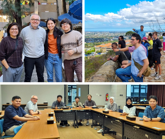
For this project, a list of 20 major planning schools in Europe, North America, Latin America, Africa, Asia, and Australia was compiled through consultations with continental planning school associations – AAPS, ACSP, AESOP, ALEUP, ANZAPS, and APSA – and through desk research. Between October 2023 and May 2024, ten planning schools across six continents were visited. During these visits, semi-structured interviews were conducted with faculty members and students, alongside classroom observations. In early 2025, an additional online survey was conducted at all 20 planning schools included in the study.
The research aims to create a "map of planning" as a discipline, offering insights into how planning is understood in different parts of the world and how the travelling concept of planning evolves across contexts. The study examines various dimensions of applied planning (e.g., comprehensive planning, sectoral planning, planning instruments) as well as the foundations of planning (e.g., core disciplines, theories, methods).
A video with a presentation about the project at the UF ABC in Sao Paulo can be found on YouTube.
Contact:
Project duration: 01.01.2023 - 31.12.2025


